Backpacking Central America works best as a north-to-south line that starts in Guatemala, where Tikal (a UNESCO site since 1979) and Lake Atitlán anchor the first stretch, then drops through the four CA-4 countries toward Nicaragua.
The route below sits within the wider backpacking category and focuses on ground travel, border logic and pacing rather than a rigid itinerary.
Why a north-to-south line suits the isthmus
Central America is a narrow strip, and a 2006 border agreement tied four of its countries together: El Salvador, Guatemala, Honduras and Nicaragua. That agreement, the CA-4, is the reason a traveler can treat the northern half of the region as one connected trip instead of four separate ones. Starting in Guatemala and heading south follows the grain of the land, the bus network and the visa rules at once.
Guatemala also front-loads the most dramatic scenery. Tikal National Park holds Maya temples rising out of rainforest, and Lake Atitlán sits in a volcanic caldera ringed by Maya villages. Beginning there means the trip opens with its highest-density sights while energy and enthusiasm are at their peak, and the later legs can be slower, cheaper and more flexible.
A line also avoids backtracking. Loops that return to a single airport feel efficient on a map, but they tend to burn days on repeated roads. A one-way route lets the final country decide the departure city, which keeps flights simple and leaves room to stay longer where the trip is going well. The sections below cover the Guatemalan anchors, the border crossings, and how to pace the southern half.
Guatemala: Tikal and Lake Atitlán
Tikal National Park protects 570 square kilometers of tropical forest, savanna and wetland inside the Maya Biosphere Reserve, according to Wikipedia’s entry on the site. The park was established in 1955 and the ruins were declared a UNESCO World Heritage Site in 1979. For a backpacker, that protected area is the single best argument for starting in the north: the ruins are large enough to fill a full day, and the surrounding forest keeps the experience quiet outside peak hours.
The city itself was once enormous. Archaeological estimates put the peak population within a 25 kilometer radius of the site core at 425,000 people, and the first modern exploration of the site happened in 1848. Those figures matter practically: walking the causeways between temple groups takes far longer than the map suggests, so an early start and a full water supply are more useful than any guidebook shortcut.
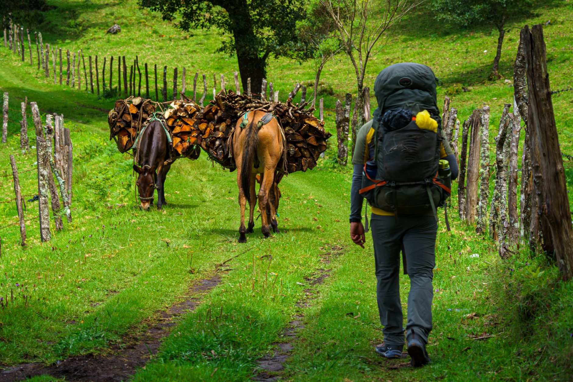
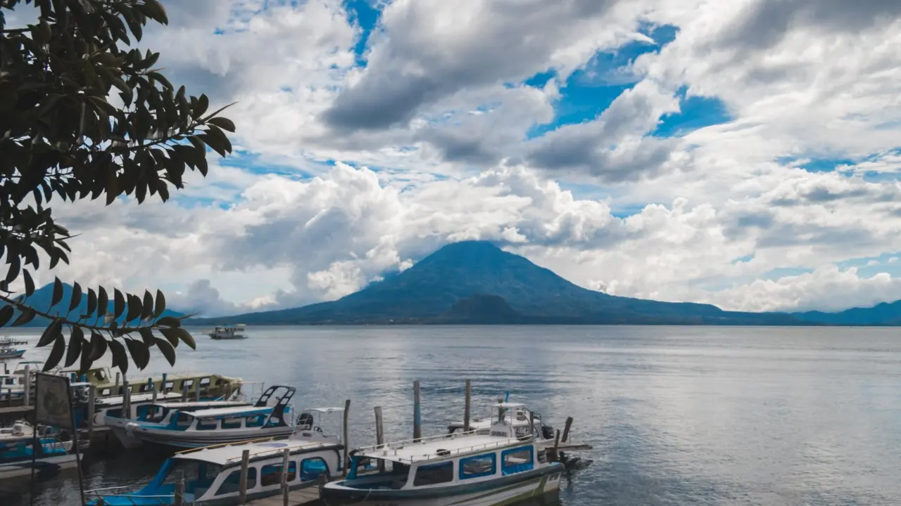
From the ruins, the logical next stop is Lake Atitlán. With a maximum depth of about 340 metres, it is the deepest lake in Central America, and it covers a surface area of 130.1 square kilometers. The lake fills a caldera formed by a supervolcanic eruption roughly 79,500 years ago, and three younger volcanoes now rise on its southern flank. Villages around the shore are home to Tz’utujil and Kaqchikel communities that keep textile and farming traditions alive, so slow days spent hopping between towns by boat pay off more than a checklist approach.
The lake is about 50 kilometres west-northwest of Antigua, according to Wikipedia, which makes it an easy add-on or a convenient exit point toward the border with El Salvador. Nothing in this section needs a booking far ahead for budget travelers; dorms and guesthouses cluster around all three hubs, and arriving without a reservation on a weekday rarely causes trouble.
How the CA-4 border zone works
Wikipedia describes the 2006 CA-4 Agreement as similar to the Schengen Agreement in Europe, establishing a harmonized visa regime for nationals travelling to the area. In practice, the four member countries (El Salvador, Guatemala, Honduras and Nicaragua) function as a single entry zone for most visitors, which changes how a trip should be planned.
The practical effect is that time spent in the region is counted across the four countries rather than reset at each frontier. Travelers who plan a long leisurely stay in Guatemala and then expect a fresh allowance in Honduras can be caught out. The agreement is also the reason overland crossings between the four are generally routine, so the trip does not need to be sliced around separate visa applications. Before leaving home, check the current rules for the specific passport being used, because the harmonized regime governs how nationals of other countries are treated, and the allowance differs by nationality and can change.
Border crossings reward a simple routine. Cross in the morning, carry small bills in local currency, and keep passport, onward-travel evidence and a printed copy of accommodation details in one accessible pocket. Official fees and minibus fares vary by crossing and shift over time, so confirm them with the hostel or driver the night before rather than relying on a figure from an old forum post.
Costa Rica and Panama sit outside the CA-4, so travelers continuing south of Nicaragua should treat them as separate entries with their own rules. Belize also sits outside the agreement, though it borders Guatemala near Tikal and is a common side trip. Anyone who prefers to keep the route simple can end in Nicaragua and fly onward from there.
Backpacking Central America’s southern half
After Guatemala, the route moves through El Salvador, Honduras and Nicaragua, the other members of the agreement. Their value to a backpacker is different from the headline Maya sites: the Pacific surf towns of El Salvador, the Caribbean-facing islands and Copán ruins of Honduras, and the colonial cities and volcanoes of Nicaragua all reward travelers who slow down rather than collect stamps. The shared structure makes it realistic to spend longer in each place, since the paperwork is shared.
A workable pattern is to alternate. Follow a high-intensity stop, such as a full Tikal day, with several low-intensity days on a lake shore or beach. The caldera at Atitlán formed about 79,500 years ago and still looks dramatic from any shoreline, which is why it works well as the recovery stop in the middle of the trip rather than a sightseeing target, as described on Wikipedia’s Lake Atitlán entry.
Transport in the region is built around shared minibuses and longer coach services, and the pace is set by road conditions and by how long drivers wait for seats to fill. Build slack into any day that includes a border, because the agreement can simplify the visa question but cannot speed up a road. Night travel is best avoided on unfamiliar routes, and the same is true of arriving in a new town after dark.
Anyone comparing this region with other budget routes will find a different rhythm. A trip like backpacking japan on a budget depends on dense rail timetables, while a route such as backpacking morocco leans on a few long hauls between medinas. Central America sits between those: flexible, bus-driven and forgiving of last-minute changes, provided each border day is treated as its own project.
Frequently asked questions
Which country is the best starting point?
Which country is the best starting point?
Guatemala is the strongest start because Tikal National Park (570 square kilometers, a UNESCO site since 1979) and Lake Atitlán both sit there, and the country is one of the four CA-4 members.
What is the CA-4 Agreement?
What is the CA-4 Agreement?
It is a 2006 arrangement between El Salvador, Guatemala, Honduras and Nicaragua that Wikipedia compares to the Schengen Agreement, creating a harmonized visa regime for nationals travelling to the area.
How deep is Lake Atitlán?
How deep is Lake Atitlán?
Its maximum depth is about 340 meters, making it the deepest lake in Central America, with an average depth of 154 meters.
Is Costa Rica part of the CA-4?
Is Costa Rica part of the CA-4?
No. The CA-4 covers only El Salvador, Guatemala, Honduras and Nicaragua, so Costa Rica has its own entry rules and should be planned as a separate crossing.